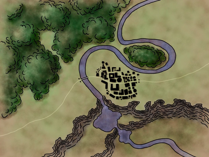
About a month ago, I posted some shots of a digital map that I was working on.

It wasn't really a map, though… more of an illustration. Sure, there was some forest, a river, cliffs, lakes, and a town—but there were no labels. As anyone who has ever tried using a map knows, those tend to come in handy. There were were also no farms. Those come in handy too. I had thought about these things, but found some satisfactory rationalizations (just a fancy word for excuses, I know), for leaving my map like it was. Among them:
"I just made this map for practice in illustration. It doesn't matter if it isn't really finished."
"I don't even know or care anything about this place. When I make a map for fantasy places that are real official, I'll label them and all that."
"How do I illustrate farms? If I try to draw fields on there, I'll probably just mess up the artistic unity of it. The same goes for labels—those would totally clutter up my nice, neat illustration."
"I don't want to come up with that many names, anyways. I'm so bad at names that the secondary villain in the book I'm writing doesn't even have a name, and place names are a step worse than people names."
These are all nice, devious, insidious rationalizations. But, as I observed, rationalization is effectively synonymous with excuse, and the term excuse carries some justifiably negative connotations. Still, my rationalizations carried the day, no. 1 being the strongest. So that map sat there for several weeks, with no changes other than a few minor tweaks to coloring.
Then my uncle left a comment on the earlier map post suggesting that I develop the map further, and when we went for a hike the next day he gave me more suggestions and some very interesting food for creativity. A map, he said, tells a story. What this story is depends on map, artist, and place mapped, but what the actors in it are is determined (to some extent) by the scale of the map. For instance, in a continent-wide map the characters might be forests, mountains, rivers, seacoasts, cities. In a zoomed-in map of a town or city, the characters will be the houses, the streets, the open spaces. Where the streets are narrow, the houses small and crowded, they will say, the city is poor. Where the streets are wide, the houses large and well-spaced, is where the rich live. On the map that I drew, the characters included the cliff, the town, the river, the lakes, and the forest. But they didn't quite tell a story. It was a pretty illustration, but it had nothing to say.
In addition to adding labels and farms, my uncle suggested, I should add another town. I was hooked, caught, and jerked out of my rationalization slump. Also, I saw a wider possibility for this map: instead of just using it as a means to an end, practice in illustration to use the experience from when I worked on a serious project, this map could be a creative act in itself. I wanted to fulfill this map. In a way, it was somewhat like my decision last October to rewrite most of my book. After I caught a glimpse of what book or map could be, I was no longer content to leave them as they were. I was pretty stoked, too, to have these suggestions and critiques coming from my uncle—I don't get much uncle time.
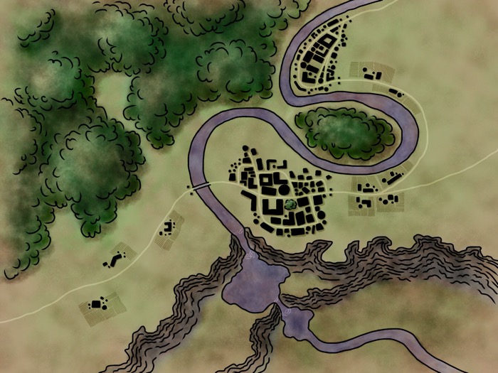
I started by going back into Procreate and adding another town and some farms.

Already, the progress amazed me. My canvas looked so much more filled out and complete. But all this just sharpened, to my eye, the need for labels.
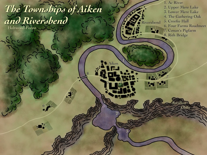
So I cudgelled my brains, and used a Modern English to Old English translator, to find some more names. Then I moved over to ArtStudio (sadly, Procreate does not currently have the ability to add text in-app) and stuck names in.

Yes, I know: I forgot to name the waterfalls. But other than that? Wow! I was amazed and gratified by how much more like a map labels made my map look. (Think of that.)
Another side effect of having labels, farms, and another town? It definitely kicked on my curiosity! Now that my map has a story, I want to know what that story is. Who is this Conan dude? What's so special about his "Pigfarm"? What's important about the Four Farms Roadmeet, and how did so many farms end up in the same spot? Why does the town of Aiken have the big "Gathering Oak" in its center? Was the oak there before the town? Was it under its shade that the first beginning of the town was founded? Speaking of that, is this the first Gathering Oak, or is there a tradition that there is always an oak in the center of Aiken, and a new oak is planted each time an old tree dies? Which town was founded first? What is their relationship? Is there a portage down/around the cliffs and waterfalls? Or is all boat traffic stopped before it reaches Aiken? What is it with oaks around this place? After all, Ac River and the town of Aiken are both named from Old English words having to do with oaks. Is this significant?
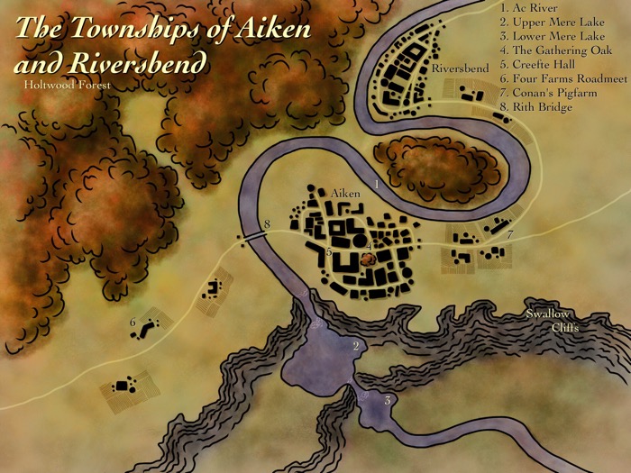
Because I could (I <3 digital art), I also tried changing the color scheme to a fall palette of red and gold. I tried black-n'-white, too, and was gratified by that my map still read well because I had done a good deal of work in saturation.
My book isn't ready for a map yet, but I plan to continue doing practice mapping on different scales. Some of the stuff I plan to try? A map of a continent, a map of a country, and a close-in map of a town or city. Another interesting tip my uncle passed on to me? Smooshing some ketchup in a paper napkin to get a realio-trulio random coastline. Something I want to do better on my next map? Defining my forests in a style closer to that on Fantastic Maps.
And one last word…
Mom informed me that I should very much not post full-sized images, mainly because of load times and formatting problems in my post-notification emails. (Dear family, I am so sorry for how badly the formatting is turning out on those. I just seem to get something wrong every time.) I still love my high-res pics, though, so if you want to see the full-size file of this map (the green version) you can do that here.
