Tag: Glacier

Days 8-9 – Camping, Kenai Lake, Exit Glacier

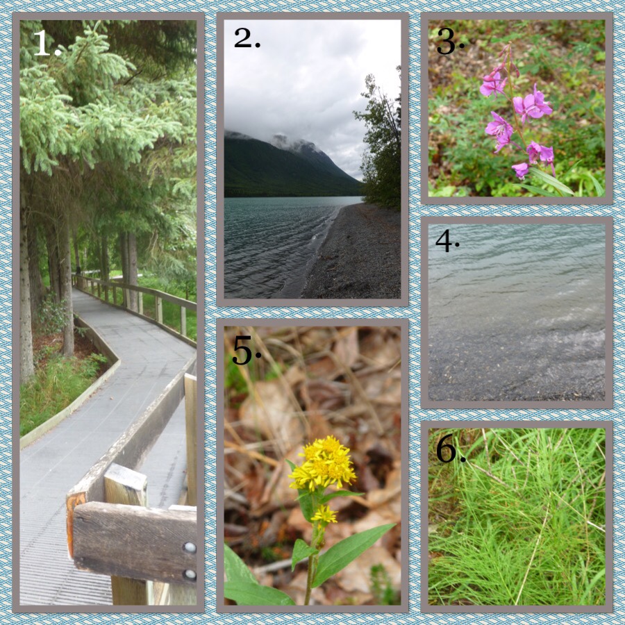
On Sunday, we set up a quite comfortable camp in the Quartz Creek Campground, by Kenai Lake, and before dinner did some exploring. I did not take a picture of the camp until the next day, which is why it is in one of these collages.

These are photos from Sunday.

  1. In the afternoon we walked out on a boardwalk to Quartz Creek, the namesake of our campground.
  2. We also walked out to Kenai Lake, which borders the campground.
  3. I have identified (and shown photos) of common fireweed before, but I liked this picture.
  4. Water at the edge of Kenai Lake. I find it interesting how the water is clear very near the shore, but blue farther out – with scum-covered rocks providing a stripe of brown between them.
  5. Northern Goldenrod?
  6. Common Horstail, which is very common indeed and seems to grow all over the parts of Alaska that I have seen

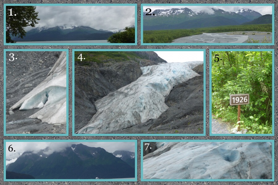
On Monday, we drove out to Exit Glacier. It is a 3.5 mile long glacier that you can hike out to (but not up to). It is named Exit Glacier because it was once used mainly as an ‘exit’ from the Harding Ice Field, which is named after a president who visited it. Did you know that 1 cubic foot of fully compacted glacial ice weighs 52 pounds?


  1. We stopped at a playground in Seward, whch Mom said has the best view of any childrens’ park that she has seen.
  2. A gravel drainage plain left by the retreating Exit Glacier.
  3. The foot of the Glacier. If you look closely, you can see water coming out from beneath it.
  4. The glacier itself!
  5. Along the path to the glacier, and also the road to the visitors’ center, there were signs marking where the glacier had been in certain years.
  6. I think this is amazing. Doesn’t it look almost as if it was carved and shaped by giant ice cream scoops? Yet, it was the ice cream that scooped it! One can just imagine the huge river of ice in the valley, and all the little tributary rivers of ice emptying into it.
  7. A close up of the glacier.


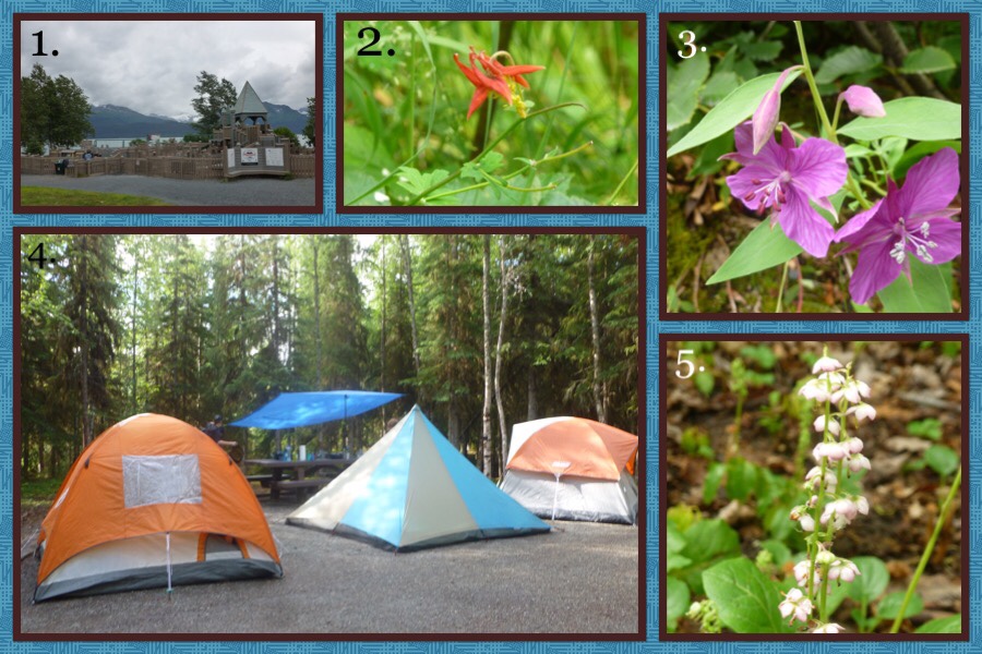
And here are some various photos I have taken:

  1. The park where we stopped. Impressive, isn’t it? Fortunately I was able to find a plug in a pavilion area near this where I charged the battery of my camera, which I should have charged in Anchorage, about 1/3 of the way. Perhaps I can find somewhere else to charge some more.
  2. Western Columbine
  3. More Dwarf Fireweed! I didn’t realize that I had put it in a collage twice today.
  4. Our camp! Or should I say Our Encampment?
  5. Pink Pyrola


By the way, I think that the plant I was unable to identify in my last post might have been Mouse Eared Chickweed.


So long for now! 😉


Day 3 in Alaska: Portage Glacier and the Whittier Tunnel

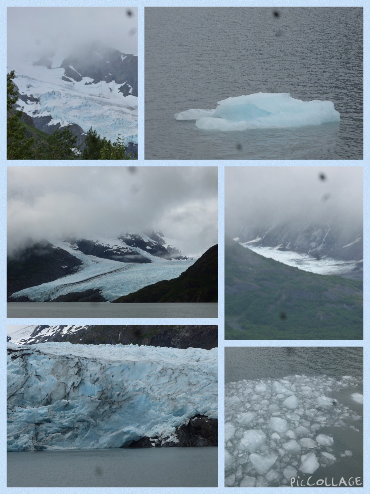
In the morning today we drove out to Portage Lake, where we went on a boat tour over to Portage Glacier. We also saw several other glaciers, all of which were quite interesting to see. This morning’s trip was also interesting because I have not seen any glaciers before.

Here are some photos I took:

Top Left: I don’t know its name but this was my first glacier!

Top Right: A mini iceberg from the Portage Glacier.

Middle Left: Portage Glacier.

Middle Right: Burns Glacier.

Bottom Left: A closeup of Portage Glacier.

Bottom Right: Some ice from Portage Glacier.


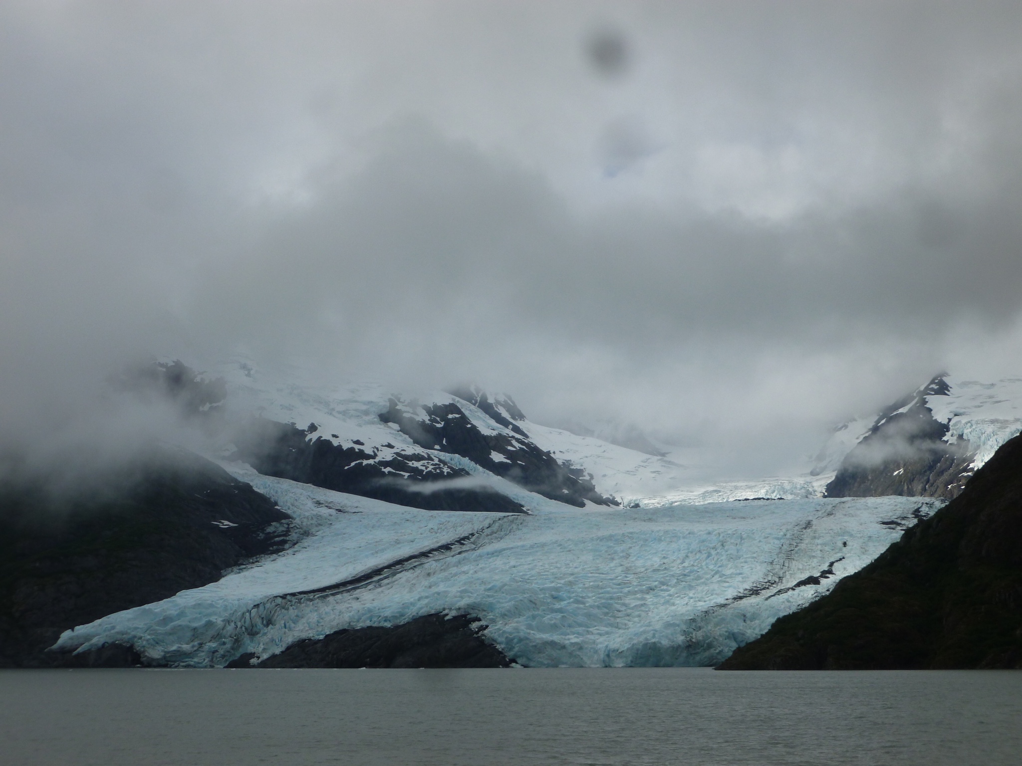
And, to crown them all, the picture of Portage Glacier – blown up:

(I really like this picture – in fact it is the new wallpaper on my home screen 🙂 )


After lunch we went out to Whittier, which is a deep water port on Prince William Sound / converted army base.

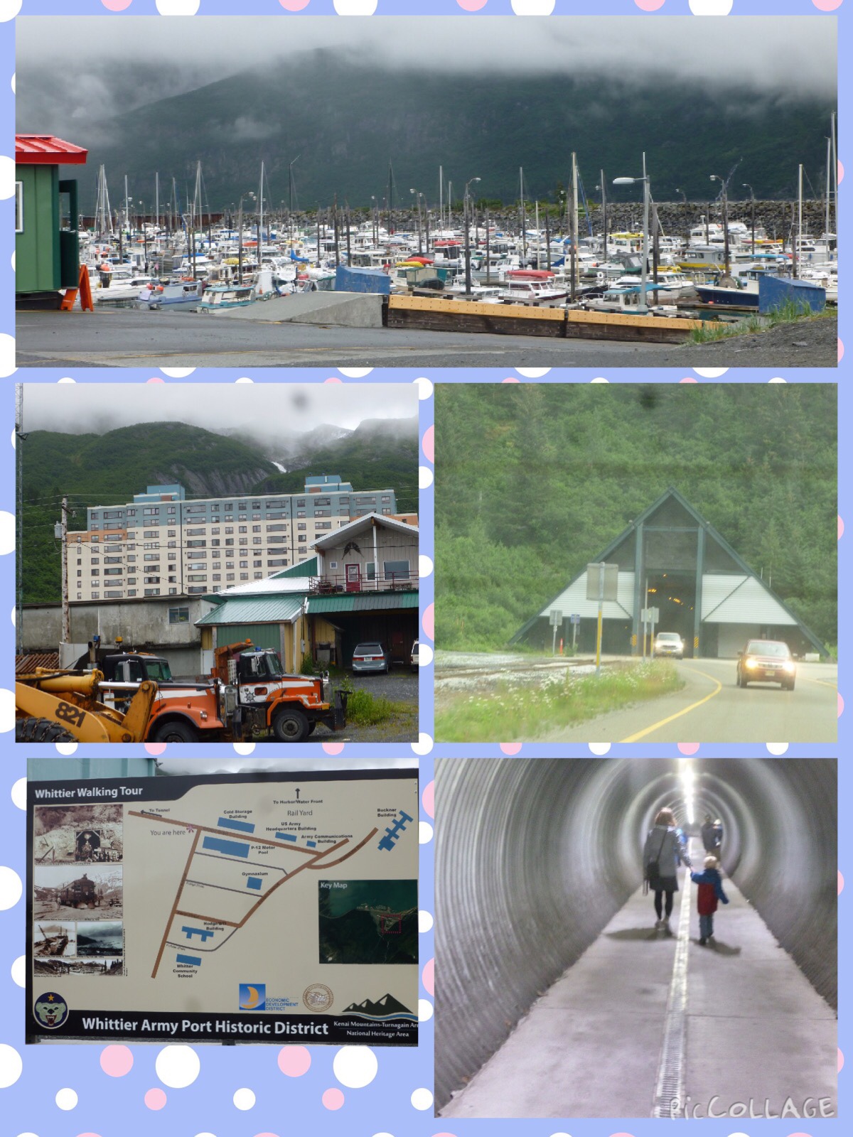
There is not much to see in Whittier, but the main attraction there is a two mile long tunnel which was built as a rail tunnel in 1943. It is now used by cars also, and is the only way to access Whittier from the land – excepting a 1 mile trail with some 700 feet of elevation gain. We went through the tunnel to Whittier, walked around a bit there, and drove back. I thought I would share some photos from Whittier:


Top: Whittier small boat port.

Middle Left: You can ignore the foreground, and focus on the converted army building that is the condo building where most of the inhabitants of Whittier live.

Middle Right: The opening to the tunnel, on the side away from Whittier.

Bottom Left: A sign with a map of Whittier.

Bottom Right: Whittier has a pedestrian tunnel going under the railyard from the waterside to the downtown.


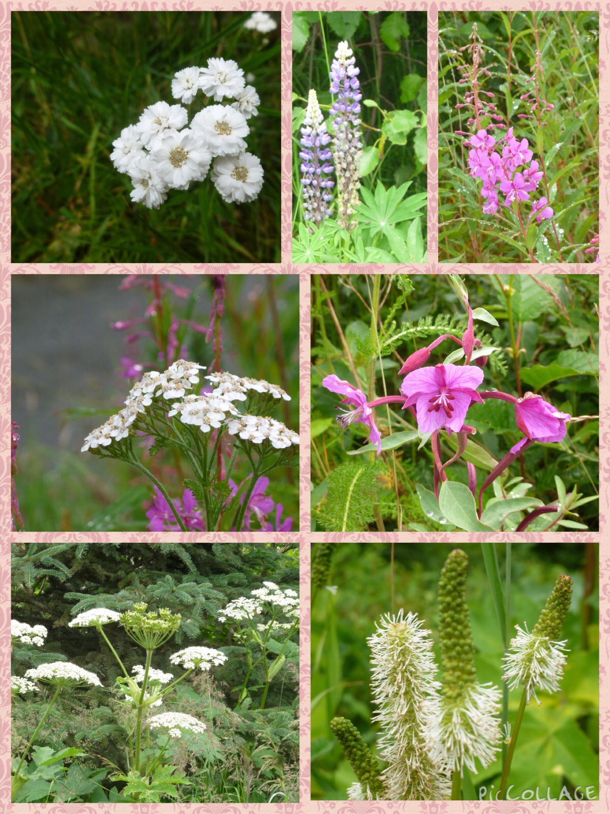
Also, I have pictures of some wildflowers that I have seen in Alaska over the past two days. I have identified as many as I can, using a flyer found at the visitor center for Portage Lake.


Top Left: A plant that is not in the flyer! Not allowed! I am not sure if this is a non-native flower, or just one that is not very common. (The flyer only has 50 flowers)

Top Middle: Nootka Lupine (?)

Top Right: Fireweed

Middle Left: Yarrow (this grows in our area down in CA, as well)

Middle Right: Dwarf Fireweed

Bottom Left: Unidentified again!

Bottom Right: And again!


I’m sorry so many of the flowers are unknown, but I did my best. 🙁


We’re all really enjoying Alaska, and I will post again soon. Goodbye for now!